_300x225.webp)

_300x225.webp)
_300x225.webp)
_300x225.webp)
_300x225.webp)
Marine Equipment
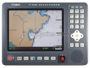
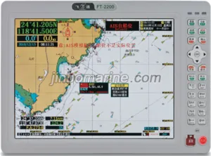
AIS Class-B (10.4-inch)
AIS Class-B (10.4-inch) (1).Main Functions 1.Automatic Identification System (AIS) function Be able to the continuous autonomous receive and transmit the AIS da...
 PDF Datasheet
AIS Class-B (10.4-inch)
(1).Main Functions
Be able to the continuous autonomous receive and transmit the AIS data information.
Can display AIS data around own ship when ships equipped with AIS equipment.
Static data including: MMSI, vessel name, call sign, IMO number, ship type, ship size, the GPS antenna position, Flag, etc.
Dynamic data include: latitude and longitude, speed, course, rate of turn ,heading, azimuth, distance.
Navigation data, including: condition of navigation, ship' draft, dangerous cargo ,destination and estimated time of arrival.
When AIS target ship enter pre-setting range ,visual and audio alarm occur ,according to range varying sound changing
Emergency information send and receive.
2.AIS target Approaching, sound (audio) and light (visual) alarm function
When ship speeds greater than 2 knots to enter own ship within the range of 0.1 to 10 nautical miles,
The red light blinks on main unit display .
At the same time ,speaker alarm tone: "The direction × × degrees ,× × nautical Target Approaching Careful avoidance."
3.Target ship information display function
List of showing the target ship (range, azimuth and 9 ID)
Vector display the target ship (provide 1-100 nautical miles range selection)
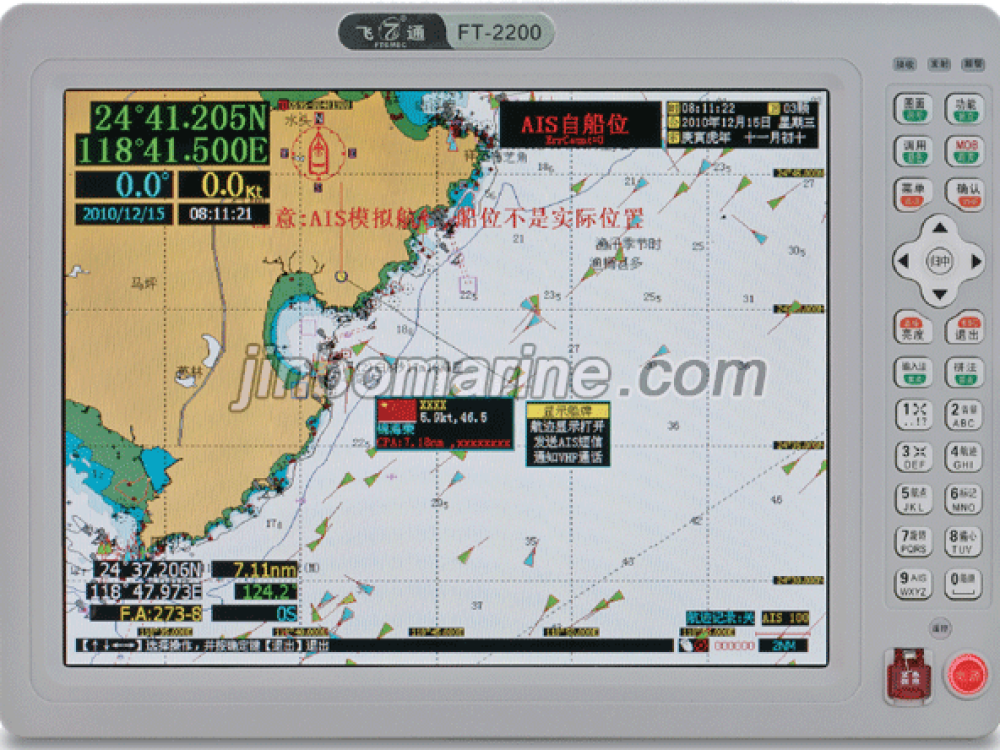
The target ship displayed on Electronic chart.
4.GPS navigation function
10.4-inch color LCD display, can display the coastline of the country charts, the Geographic Names Information data and
waypoints Routes and track setting, edit, and delete function.
Ship's position, speed, heading, course track, time and date display.
Waypoints, routes, track, store and call.
Destination position, distance and estimated time arrival display.
Navigate arriving at the destination , course deviated alarm , alarm and prompt.
10,000 waypoints can be stored, 10000 marker points, 200 routes.
(2).Technical specification
Main unit :
RF unit: 1 transmitter and 2 receivers
Frequency Range:156.025-162.025MHz
Modulation method:GMSK9600pts
Frequency tolerance:±1000Hz
Display screen: 10.4 inch TFT true color LCD
Power Supply :DC 12V-15V
Operating Temperature:-15℃~﹢55℃
Dimensions:325(W)*235(H)*135(D)mm
2.
AIS transmitter section :
Carrier power:33dBm±1.5dB
Modulation spectrum:<-25dBw
<-60dBw
Modulation accuracy:<3400Hz(Bit 0,1)
2400Hz±480Hz(Bit2,3)
2400Hz±240Hz(Bit 4-199 or 00001111 Bit format)
1740Hz±175Hz (0101 bit format)
Spurious components:-36dBm(9KHz-1GHz)
-30dBm(1GHz-4GHz)
3.
AIS receiver section :
Reference sensitivity:-107dBm(Package error rate≤20%)
High input tolerance :-77dBm(Package error rate≤2%)
Co-channel interference:10dB(Package error rate≤20%)
Adjacent Channel Selectivity:70dB(Package error rate≤20%)
Spurious response interference:70dB(Package error rate≤20%)
Intermodulation response interference:65dB(Package error rate≤20%)
Note: Specifications are subject to change without notice.