The KP-32 is an advanced GPS navigator with a SBAS receiver designed for coastal ships, fishing boats and pleasure craft. The powerful processor performs high-speed processing of position fixing and augmentation using SBAS correction. It comes with an easy to use track plotter which stores up to 2,500 track points. This compact and cost-effective unit offers extremely accurate position fixed. It is accurate to 15 meters and with SBAS mode activated, it’s accurate to within 3 meter.
Jinbo Marine
Marine & Offshore Equipment Datasheet
Product Datasheet
Communication and Navigation System
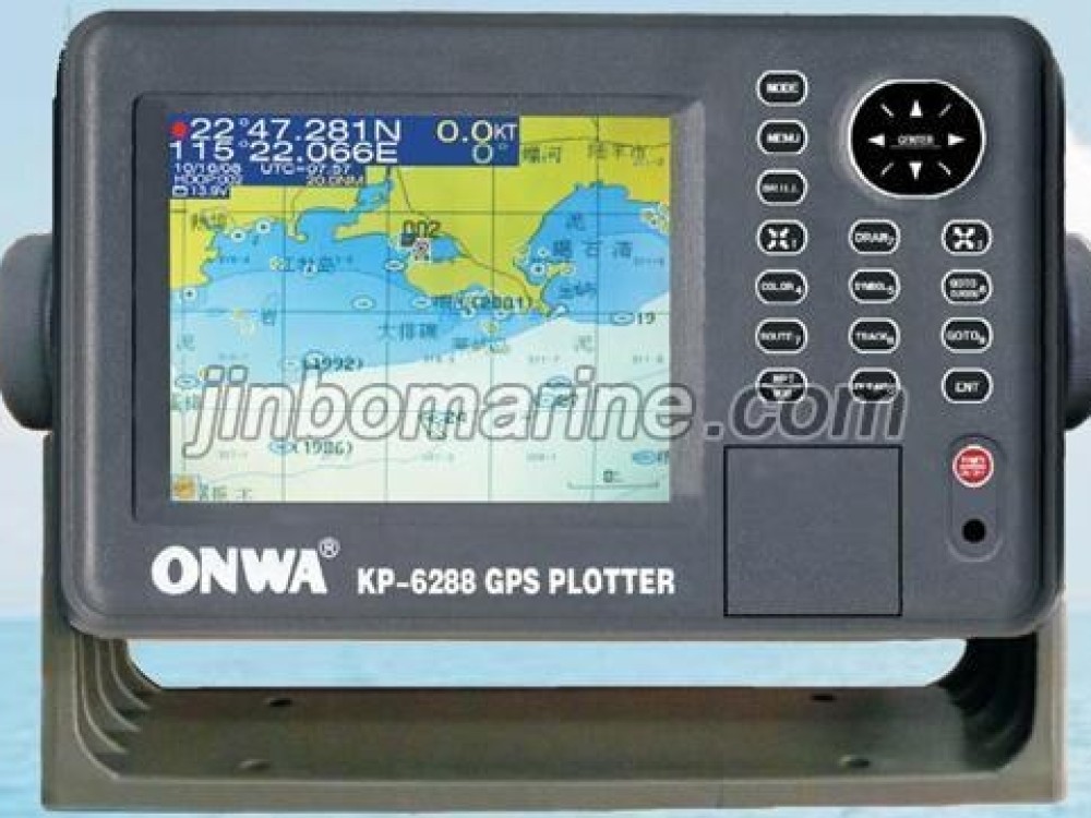
GPS Navigator
GPS Navigator General description The KP-32 is an advanced GPS navigator with a SBAS receiver designed for coastal ships, fishing boats and pleasure craft. The powerful processor performs high-speed process...
ISO9001 Supplier
Class Certificate
Export Supply
Key Highlights
Category
Communication and Navigation System
Standard
EN
Certificate
CCS
We can supply according to your requirement, drawings, class certificate needs, and delivery schedule.
Technical Specifications
Category
Communication and Navigation System
Model / SKU
GPS-Navigator
Standard
EN
Certificate
CCS
Warranty
12 Months unless specified otherwise
Origin
China
GPS Navigator
General description
Advantages
- Improved accuracy with built-in SBAS receiver
- 4.5” silver bright LCD display
- Multiple display modes to suit a variety of navigational requirements
- Up to 999 waypoints, 50 routes and 2500 track points
- One-touch waypoint entry
- Customizable NavData screens
- Track back feature stores waypoints at user defined intervals for early trace-back cruise
- Way point & Route upload/download through RS-232C port
Specifications
- Receiver type: GPS: Twelve discrete channels, C/A code, all-in-view. SBAS receiver
- Receiver frequency: L1 (1575.2 Mhz)
- Time to first fix: 15 second average(HOT start)
- Tracking velocity: 999 knots
- Geodetic system: WGS-84
- Accuracy: GPS-15m(95%), SBAS-3m(95%)
- Display: 4.5” diagonal 95(W)X63(H) mm LCD, 240x160 pixels
- Display Modes: plotter, highway, steering, speedometer, Nav data and 2 pages customizable display.
- Memory Capacity: 2500 ship’s track points, 999 waypoint with comments, 50 routes, 30waypoints
- Alarms: Arrival, Anchor watch, XTE, Speed, Time, Trip, Odometer
- Interface: output(NMEA0183 ver 2.0)
- Environment: Display unit(-15c to +55c), Antenna unit(-25c to +70c)
- Waterproofing: Display unit(IPX5), Antenna unit(IPX6).